The River Forecast Centre is issuing a Flood Watch for the Central Coast including Bella Coola River and tributaries, Kingcome River, Owikeeno/Rivers Inlet and surrounding areas.
A slow-moving frontal system is expected to sweep across northern and central coastal regions through the early part of the week. The system is expected to stall over the Central Coast, bringing two waves of precipitation; the first wave is underway and expected to bring heavy rain throughout Tuesday (Oct. 27) and following a brief reprieve on Wednesday morning, a second phase of rainfall is expected to deliver additional rainfall late-Wednesday and through Thursday.
Precipitation for Wednesday is forecast to be in the 60-100 mm range, with the heaviest rainfall focused on the outer coast regions of the Central Coast (e.g. Ocean Falls, Bella Bella). Similar rainfall amounts are expected during the second phase of the event late-Wednesday to Thursday. Environment and Climate Change Canada have issued a Rainfall Warning for the region, with the potential for areas within the region to exceed 250 mm of total rainfall for this event by late-Thursday.
With some snow on the ground at low-to-mid elevations, this is expected to melt and provide additional runoff (10 to 30 mm) to rivers. Freezing levels are expected to be in the 2000-2500m range Tuesday and Wednesday and dip down to 1500m by Friday.
Rivers are expected to rise rapidly on Tuesday, with smaller rivers reaching peak levels late-Tuesday or overnight, and overnight and early Wednesday for larger rivers, including the Bella Coola River, Owikeeno and Kingcome. Rivers may experience a small reprieve on Wednesday, with another surge in river rises coming with the second wave of precipitation later Wednesday and into Thursday.
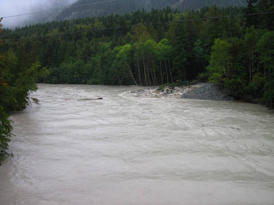
The public is advised to stay clear of the fast-flowing rivers and potentially unstable riverbanks during the high-streamflow period. The River Forecast Centre continues to monitor the conditions and provides updates as conditions warrant.
(Information from River Forecast Centre)